Hello and welcome to today’s property surveying blog post, in today’s blog we are going to be taking a look at Building Surveying procedures.
Taking a close look into Boundary Surveying matters breaking down what a boundary survey will entail from the site inspection to the desktop research and the report.
What is Boundary Surveying?
Boundary surveying can be a very complex area of surveying, with most of the housing stock in the UK being constructed the turn of the century and so the original conveyance plan that the contractors would have worked from when constructing the plots being lost throughout the ages.
What does a Boundary Surveyor do?
When instructed, a boundary surveyor will initially begin with a conversation with their client, enabling the Surveyor can gain an understanding of the background of the issue or dispute if there is one.
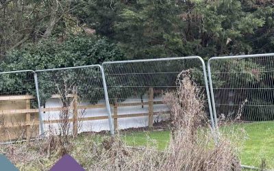
The Surveyor will then move to the site inspection, where they will pay close attention to anything that may give them an indication of the boundary position.
What does a Boundary Surveyor look for?
They will be on the lookout for things such as historic posts, which are usually made of steel and embedded into the ground, the lay of the land, paying close attention to the construction design of the relevant plot and the subsequent surrounding plots.
Certain features of a property can also be used to give the boundary surveyor an indication of where the boundary line will lie, such as the window opening between two properties can be a good way to find the center between two properties as there are usually unchanging aspect.
What tools does a Boundary Surveyor use?
While on-site the boundary surveyor is also likely to use a variety of tools to aid and assist them with their inspection which will include but not be limited to the following:
Tape Measure
A tape measure is one of the core tools that is used by any boundary surveyor and will be used during the site inspection to take a variety of measurements while on site.
Electronic Distance Measure
An electronic distance measure is also likely to be within a boundary surveyor’s toolbox, with most being accurate to 5-10mm per km.
Chalk/Tape
Chalk and tape are great tools for marking measurements in a noninvasive way.
Ladders
A ladder always comes in handy while caring out inspections to get to those hard-to-reach places and during a site inspection you are likely to see a boundary surveyor going up and down one to access different elements of the property.
Camera
A 4K HD Camerer – the boundary surveyor will also take a range of photographs while they are on-site to ensure that there is a thorough record of the site investigation and the methodology that was used to come to their determination, so is a key tool for evidence gathering.
What does a Boundary Surveyor look at?
Once the surveyor has completed the site inspection part, they will then move on to the desktop element of the procedure.
This will consist of the Surveyor gathering different information from a variety of sources to cross-reference the information with each other and to the information that was gathered during their site inspection.
HMLR Title plans – are used to give an illustration of what is described within a Register and will give a general indication of the extent of the size of the plot and the position of the boundary, so they can be used to give the Boundary Surveyor a good indication of the intended boundary line.
Conveyance plans are a great resource if available and can be considered the holy grail when it comes to boundary surveying as they will come with dimensions of the respective plot that the contractors would have used when building the plot.
OS Maps are a great tool to see the current layout of the plot as it stands today as they are updated every 6 months, although they do have a downside as the OS are only capable of giving a depiction of the way the plot looks at the time of the last update and so if the position of the fencing is off then this would also be off on the OS Map.
Historic Maps and photographs can be a way for a Boundary Surveyor to assess the changes to the lay of the land and the property throughout time and allow them to see what historic elements of the plot remain.
Planning records can be a good way to see the way that the plot and the property have changed over time and the different additions that it may have gained through the ages.
Once the boundary surveyor has gone through and reviewed all the documentation that they have been able to gather they will then begin to compile their findings into a report, which they will then present to you.
Thank you for reading today’s blog post, if you have any further questions or queries in regard to today’s blog post or any of the other services that we offer here at Stokemont, please feel free to get in touch.