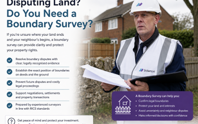
Here at Stokemont, we know that boundary disputes can be stressful, expensive and surprisingly complicated. But what actually goes into establishing where a property’s boundary should be?
Whether it’s a neighbour moving a fence, constructing a wall or claiming a section of your garden, boundary disputes are something we regularly encounter at Stokemont.
One of the biggest misconceptions is that establishing a boundary is simply a matter of checking the Land Registry title plan. Unfortunately, it’s rarely that straightforward!
Our boundary reports combine historical research, documentary evidence, site inspections and professional analysis.
Importantly, no two reports are alike. Each investigation is shaped by the evidence available and the information uncovered along the way. Nonetheless, here’s what typically goes into the process.
1. Reviewing Historic Conveyance Plans
One of the first things we investigate is the original conveyance or transfer documentation, usually starting with your own property.
These documents can contain valuable information about the original boundary position, including measurements, reference points and sometimes ‘T’ marks indicating maintenance responsibilities.
Interestingly, older conveyance plans can occasionally contain more useful information than modern Land Registry plans.
However, in today’s digital age, we find that very few property owners retain copies of their original conveyance plans. Once lost, these documents can be difficult to retrieve, so if you have one, keep it safe!
2. Reviewing Land Registry Records
We review the property’s Land Registry title deeds and plans, together with those of neighbouring properties where relevant.
However, there’s an important distinction many property owners aren’t aware of.
Land Registry title plans generally illustrate the approximate position of boundaries, rather than their precise legal location.
To put this into perspective, on a title plan drawn at a scale of 1:1,250, just 1mm represents 1.25 metres on the ground!
It’s therefore easy to see why attempting to establish a precise boundary through scaled measurements from a title plan can be highly misleading.
3. Investigating Historic Maps
Historical maps can provide fascinating insights into how land and property boundaries have developed.
We regularly review Ordnance Survey mapping and historical records, including those available through the National Library of Scotland.
These can help identify historic boundary alignments, former structures and changes to the surrounding land.
This is often one of the most time-consuming parts of the process. Historic mapping platforms aren’t always particularly user-friendly, and it’s rarely as simple as entering a postcode and finding the answer!
It requires careful research, interpretation and professional judgement.
4. Reviewing Google Earth and Historical Photographs
This is often one of the most revealing parts of our investigations!
Google Earth allows us to review historic aerial imagery, sometimes spanning several decades.
By comparing images taken over different years, we can identify changes to fences, hedges, walls and other boundary features.
Historical photographs supplied by property owners can be equally valuable.
A photograph taken years before a dispute arose may provide important evidence of where a boundary feature previously stood.
5. Undertaking an On-Site Boundary Inspection
Desktop research is only part of the process. This is where our surveyors’ practical experience really comes into play.
We attend the property to inspect the physical boundary features and compare them against the documentary evidence.
This can involve examining fence lines, walls, posts, pathways and other relevant features.
We also take photographs and use measuring equipment, including tape measures and electronic laser measures, to record relevant distances and discrepancies.
Think of this stage as an on-site fact-finding mission. Our surveyor carefully and systematically inspects, measures and records the physical evidence to build an informed picture of the boundary.
6. Bringing the Evidence Together
Once the research and inspection are complete, we assess the evidence collectively.
Do the historic plans align with the current fence? Have boundary features moved over time? Do the measurements and photographs support the documentary information?
Our findings are brought together in a detailed written report, supported by photographs, plans and a reasoned professional opinion.
This is where the surveyor’s experience, technical understanding and professional judgement are particularly important.
Crucially, our role is to provide an impartial assessment, not simply to support the position of the person instructing us.
Can a Boundary Report Resolve a Dispute?
In many cases, a well-researched boundary report can provide the clarity needed for neighbours to reach an agreement.
Our reports are deliberately approached and worded in a neutral, conflict-conscious manner.
We’re aiming to encourage resolution, not simply give our client an “aha!” moment to take to their neighbour!
However, a surveyor’s report does not legally determine a boundary or compel another owner to accept its findings.
Where agreement cannot be reached, the report can help inform discussions with solicitors and establish the appropriate next steps.
Getting the Right Advice Early
Boundary disputes can quickly become expensive, particularly when neighbourly disagreements escalate into legal proceedings.
At Stokemont, our boundary reports are designed to provide a clear, evidence-based professional opinion, helping property owners understand their position before deciding how to proceed.
Concerned about your property’s boundary? Get in touch with Stokemont to discuss how a professional boundary report could help, you can also get an instant quote!