Boundary Disputes That Aren’t Stressful or Expensive
Boundary disputes can become some of the most stressful and expensive disagreements between neighbouring property owners.
They often begin with something relatively simple: a fence appears to be in the wrong place, a hedge has been removed, an old structure no longer exists, or two sets of plans seem to suggest different things.
The difficulty is that boundaries are rarely determined by one piece of evidence alone.
That is why professional boundary surveying is so important. At Stokemont, our approach is to consider the available physical and documentary evidence together, building a clear and reasoned picture of the apparent boundary position.
Looking Beyond the Fence Line
One of the most common misconceptions in boundary matters is that the current fence line must represent the legal boundary.
That is not necessarily the case.
Fences are replaced. Hedges are removed. Walls are rebuilt. Gardens are landscaped. Over time, the physical appearance of a boundary can change significantly.
For that reason, a surveyor must look beyond what is visible on site today and consider how the current features relate to the wider historical and documentary evidence.
The same applies to Land Registry title plans.
Title plans can be useful in showing the general position of a boundary, but they are not intended to define the exact legal line to survey accuracy. Scaling directly from them can therefore be misleading.
A proper boundary assessment should therefore consider a much broader range of evidence.
Depending on the circumstances, this may include Land Registry title documents, historical conveyances, Ordnance Survey mapping, historical maps, planning records, aerial imagery, existing walls and fences, remnants of former features and measurements taken during the site inspection.
The value comes from comparing these sources and asking whether they tell a consistent story.
Why Historical Evidence Can Be So Important
Historical evidence is often particularly useful where the physical boundary has changed over time.
In one recent Stokemont investigation, historical mapping from different periods was compared with Land Registry documentation, Ordnance Survey information, planning records and aerial imagery.
Despite the age and variety of the records, the sources repeatedly indicated a broadly consistent boundary alignment.
This type of comparison can be extremely important where a modern fence appears to depart from the historic pattern.
Rather than treating the current fence as definitive, the surveyor can assess whether its position is supported by the wider body of evidence.
Bringing the Documentary Evidence Back to Site
Desktop research is only one part of the process.
The site inspection is where the documentary evidence can be tested against the physical reality of the property.
A surveyor may look for changes in fence alignment, differences between adjoining posts, remains of older structures, historic wall lines, hedges, changes in ground levels and the continuation of neighbouring boundaries.
The objective is not simply to measure what exists today, but to understand how those physical features relate to the historical picture.
In the report forming the basis of this article, the site inspection identified a generally consistent physical alignment across a number of adjoining plots, with one particular fence departing from that general line.
That anomaly was significant, but it was not considered in isolation.
Instead, it was compared with the documentary evidence to determine whether the departure was historically supported.
That is an important distinction.
A fence can provide evidence of a boundary, but it does not automatically define it.
Measurements Help Explain the Difference
Measurements are also useful, but again they need to be treated in context.
Where a fence, wall or other feature appears to deviate from an adjoining alignment, measurements can help establish the extent of the physical difference.
However, those measurements do not, by themselves, establish ownership.
The Stokemont report made this distinction clear: measurements were used to illustrate the difference between the existing physical features, rather than being treated as proof of the legal boundary position.
This is why boundary surveying is not simply a measuring exercise.
It is about weighing evidence.
The Strongest Conclusions Come From Consistency
The most persuasive boundary assessments are usually those where several independent sources point in the same direction.
In the case reviewed for this article, there was notable consistency between Land Registry title plans, Ordnance Survey mapping, historical maps, planning documentation, aerial imagery and the physical features observed on site.
Taken together, these different sources provided a far stronger basis for professional opinion than any single plan or fence line could have done.
This cumulative approach is central to Stokemont’s method.
Rather than placing too much weight on one source, the surveyor considers the overall evidential picture.
What a Boundary Report Can and Cannot Do
It is equally important to understand the limits of a boundary report.
A professional boundary survey can provide a detailed and evidence-based opinion as to the apparent boundary position, but it does not itself create a legally binding determination.
Questions involving legal ownership, historical agreements, conveyances, possession or adverse possession may ultimately require legal determination where the parties cannot agree.
That does not reduce the value of the survey.
In many cases, a carefully prepared report can help both sides understand the evidence, narrow the issues in dispute and create a more informed basis for discussion before the matter escalates.
Why Early Advice Matters
Boundary disagreements often become more difficult once positions have hardened.
A relatively small area of land can lead to significant professional and legal costs if the underlying evidence is not properly understood at an early stage.
Obtaining an independent professional assessment can therefore be a valuable first step.
A boundary report can help answer practical questions such as:
- what the title documents actually show;
- whether historic plans or mapping support the current position;
- whether the existing fence appears consistent with the historical evidence;
- whether neighbouring boundaries support the same alignment;
- what aerial imagery or planning records reveal;
- what physical evidence remains on site; and
- what limitations exist within the available evidence.
These questions are often far more useful than simply asking whose fence is in the wrong place.
How Stokemont Can Help
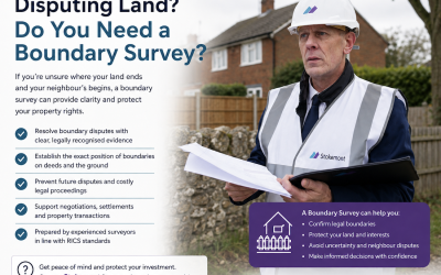
At Stokemont, our boundary surveying work combines site inspection, measurement, documentary research and professional analysis.
Where appropriate, our surveyors can review:
- Land Registry title documents;
- Ordnance Survey mapping;
- historical maps;
- planning application records;
- aerial imagery;
- existing boundary structures and features; and
- measurements and observations taken on site.
The purpose is to provide a clear, impartial and evidence-based opinion on the apparent boundary position.
Our reports are designed to help clients understand not only where the boundary appears to lie, but also why the available evidence supports that conclusion.
Concerned About a Boundary?
If you believe a neighbour’s fence, wall, hedge, extension or other feature may not follow the correct boundary, obtaining professional advice early can help prevent the matter from becoming unnecessarily contentious.
Stokemont can assist with detailed boundary inspections, documentary research and professional Boundary Reports designed to bring clarity to complex or disputed boundary matters.
A boundary dispute should not begin with assumptions. It should begin with evidence. Contact Stokemont to discuss your boundary surveying requirements.